
After a great few days at Shroud Cay, we moved to the next island south in the Land and Sea Park – Hawksbill Cay. But not before a giant U-Turn!
When the West Wind Blows
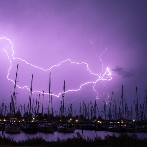
We departed Shroud Cay when a strong west wind was on the horizon. This was no place to be in a strong westerly. There are limited options for westerlies in this area, but we felt we had found a great option in Hawksbill’s southern mooring field. As we approached, one of the catamarans moored inside hailed us and said we’d only make it in at high tide (3 hours away), that there were no pendants (so someone would have to get in the water), and noted that with the high tide requirement we could be stranded for days because they were shifting to both occur in the dark. We didn’t know at the time, but they were leaving in a few hours for an unmarked location around the corner.
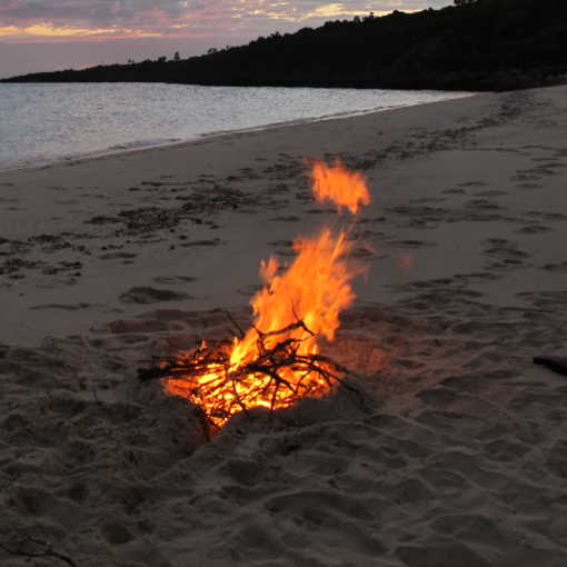
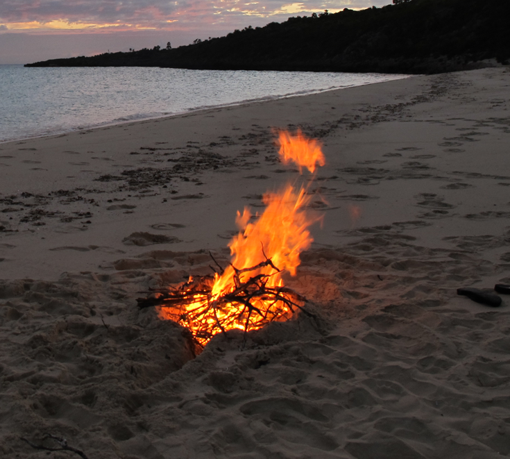
Time for Plan B, around Little Cistern. However, now that the option was upon us, Brenda vetoed it. We didn’t have a Plan C. We circled for awhile until deciding that, rather than panic into something unknown, we would choose Plan Machismo for this storm and return to Shroud. South of Shroud Cay is an expanse of clear sand than gradually shallows to nothing. We parked ourselves in front of it, laid out a 12:1 scope (130-140 feet of chain), and faced into the west wind. There had been a dozen boats at Shroud the previous day, but now we were alone.
Our bow rocked up and down wildly, and it was impressive to look out the window to see water, then sky, then water again. We love our Rocna anchor and how our Leopard 48 carries herself. I set an alarm to check every 30 minutes, in addition to our usual anchor alarm, but otherwise slept.
Hawksbill North
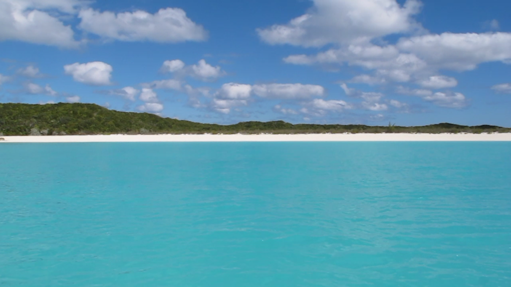
With a week of clear weather before us, we returned to Hawsbill Cay. The north anchorage is a beautiful spot, with a wide clean beach and several hiking trails. We had it all to ourselves.
Russell Family Ruins
After the U.S. Revolutionary War, those loyal to the English crown, known as Loyalists or Tories, were persecuted. This was particularly true of the Loyalist southern plantation owners, many of whom fled to the Bahamas. They brought what they knew, but the dry limestone of the Bahamas is nothing like the fertile Carolinas and attempts to recreate their plantation lives failed.
In 1785, the Russell Family was given a grant by The Crown to settle Hawksbill Cay. The ruins from their efforts remain to this day. Question is – can you find them?
We spent two days relentlessly searching, swearing to never give up. The only hints were buried in Active Captain anchorage reviews and what blogs Google could find. Combined, they present a pretty inconsistent picture.
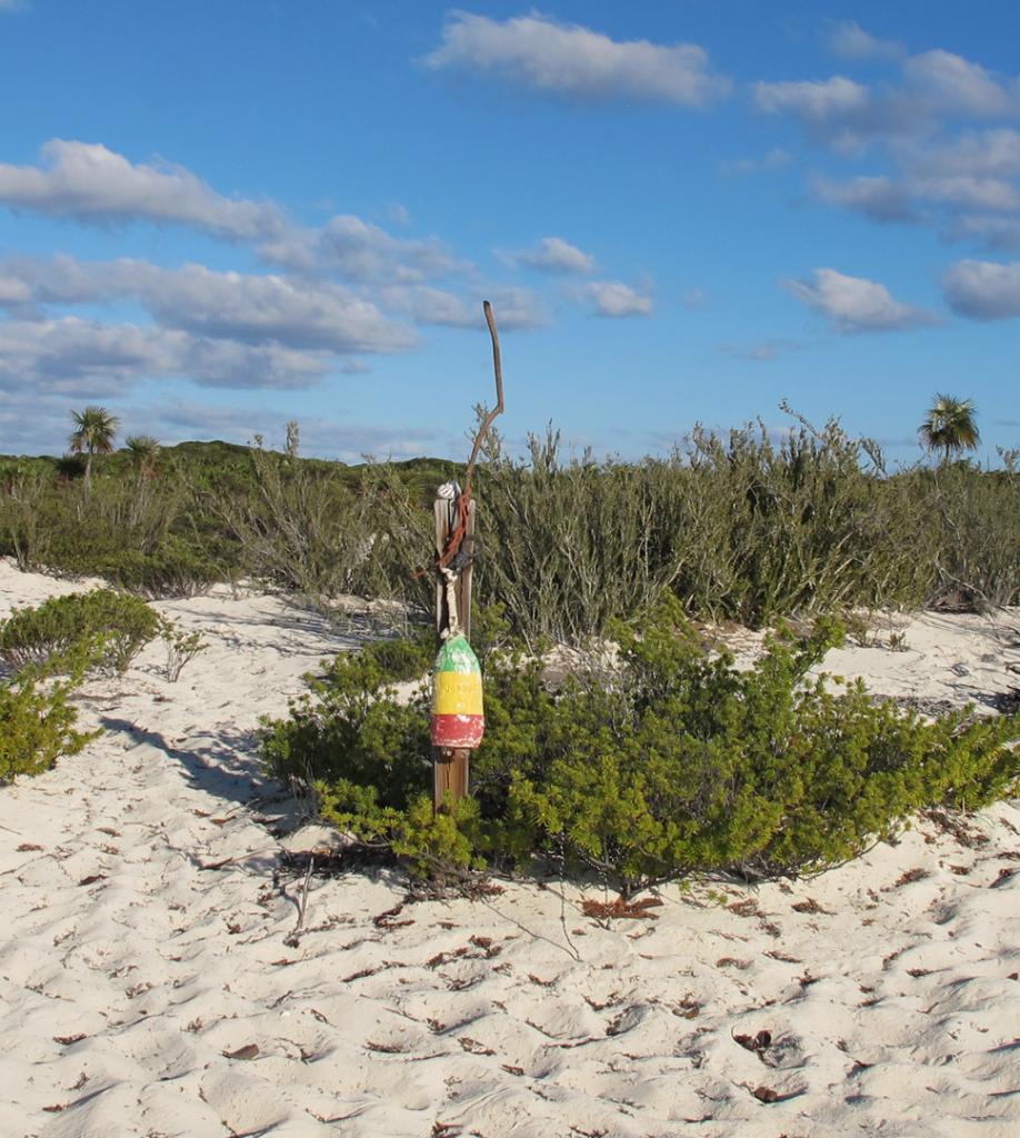
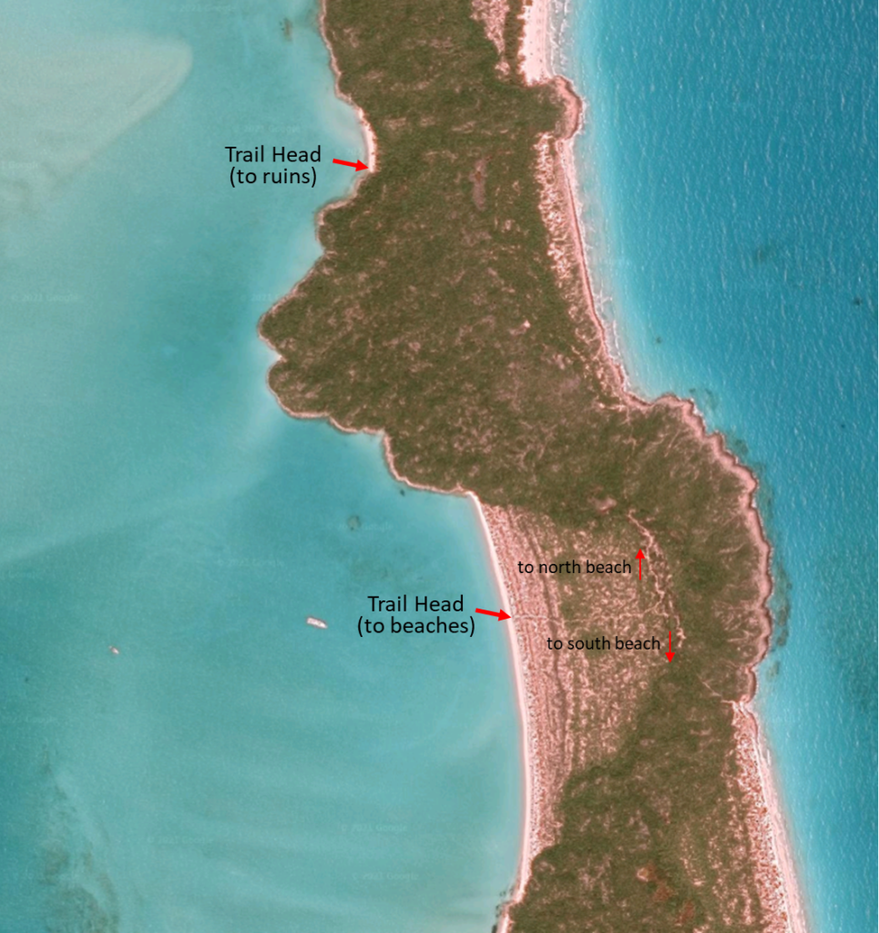
Most suggested they can be found via a trail from the main beach, which splits into two. The right branch goes to a beach on the Exuma Sound side of the cay, while the left branch leads to the ruins. We rummaged through the brush for about two hours and couldn’t find the trail. Most said that the ruins were to the north, so we focused on the north side of the beach before giving up. Subsequent research suggested a “pole” or “sign” marked the starting point, which we finally found at the beach’s midpoint. It was a tri-colored buoy hanging from a 2×4.
Off we went! After some time, we found the fork and turned left toward the north and up the hill. The view was terrific, but eventually the path led downhill to a beach on the Exuma Sound. No ruins. Had we taken the wrong fork?
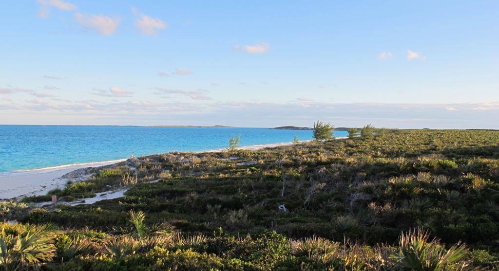
We backtracked and took the other fork. Surely this would be it. Or not. Instead, we came upon a long beautiful beach on the Exuma Sound. How can this be? Perhaps we had the wrong beach?

Returning to the dinghy, we headed north and checked every beach (or so we thought). No luck. But we did see a great shoreline and visited the giant sandbar between Shroud and Hawksbill. Just north of us was an old wooden ship that had washed onto the rocks some time ago. Its mast was a tree trunk!
We were scheduled to leave the next morning, but we decided to give it one more try. Some of the anchorage reviews had said “around the corner”, which is where the wrecked wooden ship was located. Sure enough, we had been so focused on the ship wreck that we never actually landed on the beach next to it. There, a short distance up the hill to the right, we found the Russell Ruins sign.
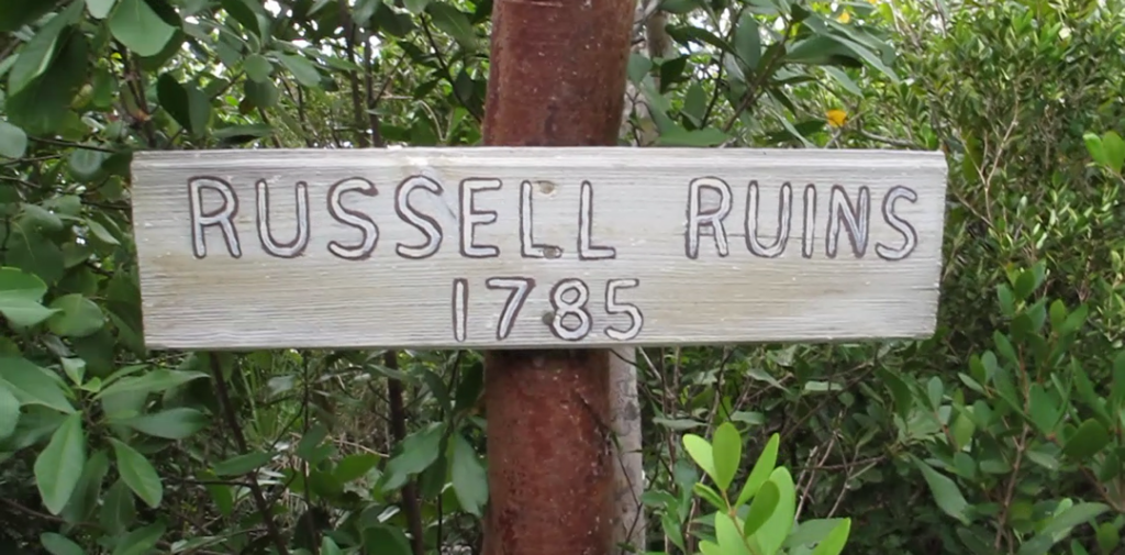
The trail leads up the hill to the remains of several small one room houses, made from sandstone, coral, and wood that was held together and surfaced by burnt conch shell mortar. We were fascinated by the mortar in particular, which looked like concrete. How did they get that here? It turns out you can burn sea shells to make quicklime (see burning sea shells to make quicklime), which when mixed with water, sand and broken shells produces a nice concrete-like substance sometimes called “Tabby” (see Tabby Concrete). It was a technique used throughout the southeast U.S. during that period.
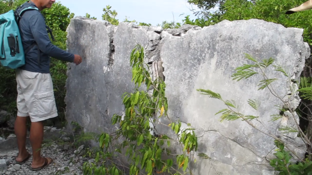

There isn’t much left beyond some stand-alone walls scattered around the brush. We also found old wells and the beehive oven used for cooking and incinerating conch shells. There were many burnt shells scattered about. While the views were spectacular, we couldn’t imagine how they were able to arrive here and survive. Coming from a relatively plush Carolina plantation life, they showed impressive resilience.
Hawsbill Southwest
After finding the ruins, we moved down to the southwest mooring field. The wind and current were light and in the same direction. Perfect for our first ever mooring! I was able to make a very slow approach while Brenda muscled the heavy pendant up and slipped the lines through. Simple. (we’re still working on getting her to drive ☺) What truly made it simple though was Brenda’s clever innovation. She mounted our GoPro at the bow and streamed its video to the iPhone I had at the helm. I was able to see the mooring ball and maintain control without her having to guide me. We were each able to focus on our respective duties, and actually seeing the ball is far easier than trying to interpret hand signals or verbal directions.
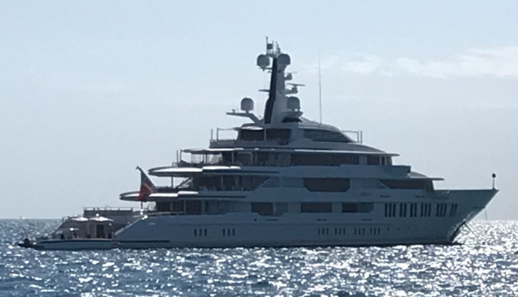
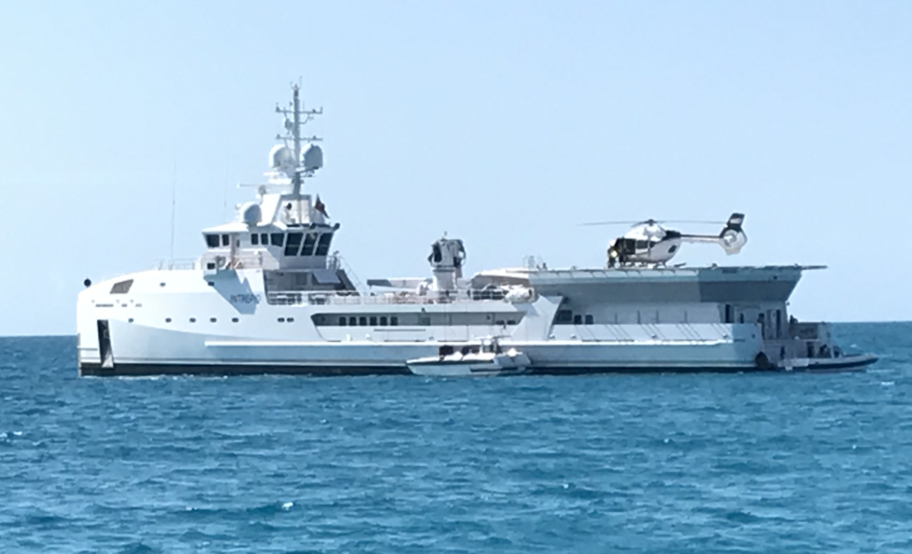
A huge mega yacht is parked near this mooring field. Emphasize huge. You know you’re huge when you have an even larger second boat for all your toys, including helicopter.

We also had a few smaller yacht neighbors. One of my favorite things unique to cruising is the night. Stars bright enough to see by. The moon laying a track over the water. And the surprises you find while getting up at 2 am to check the anchor. One night it was dead calm, and the colors and reflections of our neighbors was captivating.
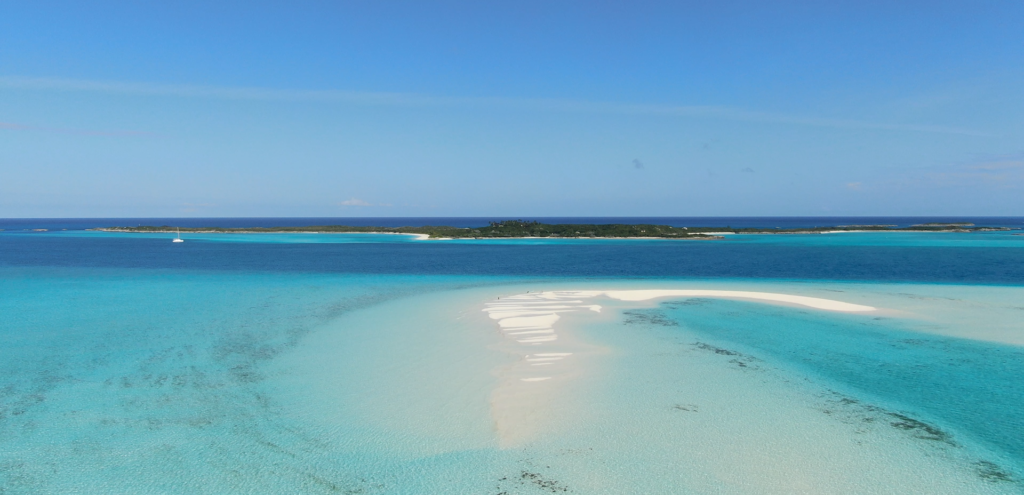
Cistern Cay
After several days exploring Hawksbill Cay, it was time to continue south. On the way, we stopped for lunch at the next-door Cistern Cay. Specifically, the extremely long and narrow sandbar next to it. Brenda had been eying this sandbar for days in the charts and we just had to go there at low tide. It was also a perfect time to break out our drone! What a fantastic spot.
